
Last week, Kath and Lydia returned from a week’s trip to Java, Indonesia, after completing the second and last trip to visit our Project Partners there, as part of the NERC-funded Innovation Project. (You can read more about our first trip here.)
The visit involved a Condatis training session, a workshop to convey the results of our Indonesia case study to our Project Partners and an excursion to see restoration projects in action within the landscape we had been modelling in Condatis.
On Wednesday 28th November, Kath and Lydia held a one-day training course at the Institut Pertanian Bogor (Bogor Agricultural University), one of the oldest, largest and most prestigious universities in Indonesia. It specialises in agriculture, but has large Faculties of both Forestry and Natural Resources and Environmental Management. Organised by Pak Lilik Budi Prasetyo, our academic partner in Indonesia, we had 16 attendees from across faculties and several more from independent organisations and companies, such as the Center for International Forestry Research (CIFOR) and Asia Pulp & Paper (APP). Kath introduced Condatis to the and Lydia led participants through our training exercises. Before she’d finished explaining all of the steps required to perform your own analyses in Condatis, many were already displaying their completed output maps in QGIS! We were thoroughly impressed! At the end of the day, we were able to field some very interesting (and challenging!) questions and to discuss what analyses the participants are interested in doing themselves.
The following day, we met with the staff of Mount Halimun Salak National Park, TNGHS. The meeting was opened by the Head of the Park, Ir. Awen Supranata. It was great to see familiar faces from Jenny and Lydia’s trip back in July, and for Kath to put faces to names for the first time. Kath and Lydia presented the results of the Halimun-Salak case study (Fig. 1 gives a taster) to our Project Partners working at TNGHS, and discussed how the project could be extended in the future to create more realistic scenarios of potential restoration for the wildlife corridor that the staff of TNGHS are particularly interested in at present.
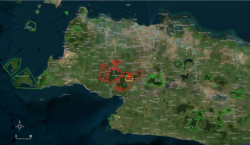
A map showing the distribution of protected areas within West Java (green), highlighting the location of the Mount Halimun Salak National Park (Tamun Nasional Gunung Halimun Salak) (red) west of the city of Bogor, on the island of Java; the area of interest is shown within the yellow box.
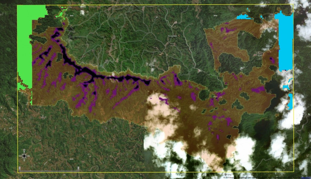
A flow analysis output from Condatis, displayed in QGIS with a Bing Aerial basemap. For this analysis, the following parameters were used: the species of interest was the Javan leopard, Panthera pardus melas, with a dispersal distance of 4.2km and reproductive rate of 1 individual per km2; Mount Halimun was set as the Source, Mount Salak as the Target; the Source/Target were created as 0.5km buffer zones along the edge of the corridor.
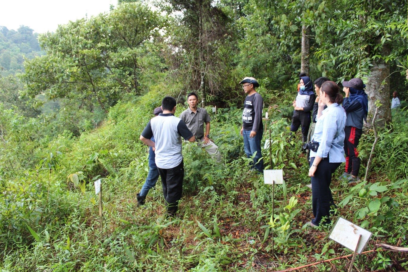
On Friday 30th November, we had the privilege of visiting two villages in which the National Park staff, the NGO, Kehati, and various other organisations are working on collaborative restoration projects (Fig. 2). These villages lie just south of the approximately 8km-wide wildlife corridor between Mount Halimun and Mount Salak: a stretch of the National Park that contains varying quality of habitat for the species needing to move through it, e.g. the Javan leopard, Javan gibbon and a variety of smaller mammals and reptiles. We were very impressed by the projects we heard about, both due to the scale of forest restoration that was underway but also because of the integrity of the projects: attention had been paid to offsetting reduced forest/land use with appropriate alternative livelihoods and organic, low-cost methods of trying to improve yields on current agricultural land. The jovial relationship between village members and National Park staff paid testament to the necessarily collaborative nature of the project. We were also told that the Park attracts a significant amount of ‘tourism’ from other Indonesian National Parks by staff keen to learn from TNGHS’s experience of running successful forest restoration projects. We hope that Condatis might help to plan where to focus the next round of restoration projects in the near future.
We are very grateful to everyone whom came along to our workshops in Bogor, to learn more about Condatis and the case study we performed in TNGHS. We are especially thankful to Pak Lilik and Pak Erlan for all of their help in organising our visits and populating our meetings. We hope this is just the start of a Condatis collaboration on the fertile island of Java.
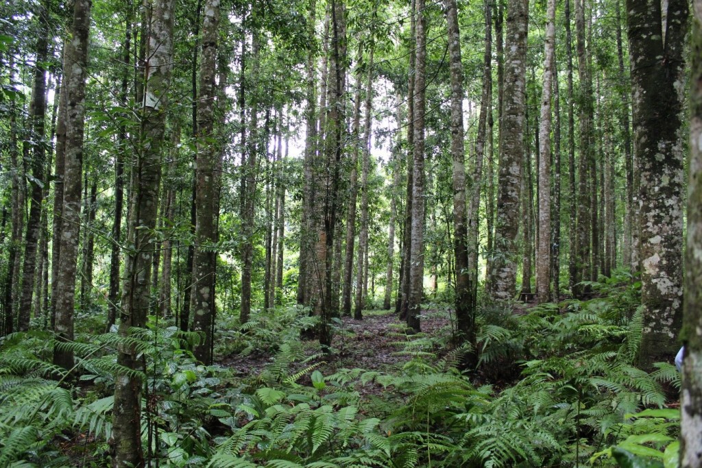
A forest dominated by Agathis sp., which is now being managed by the village after being owned by a company some years ago. The trees are now rarely tapped for the resin they contain.

A demonstration plot, showcasing some of the tree species the villagers are planting within their restoration sites to encourage a more natural forest to reform. This village is located on the southern edge of the corridor between Mount Halimun and Mount Salak, south of Bogor, Java.