
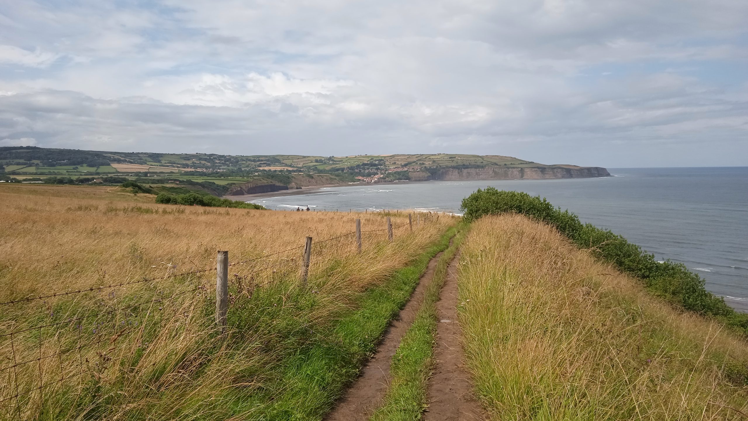
A blog contributed by Daneen Cowling, Nature Data Solutions
The Yorkshire coastline runs roughly 145 km from the Tees Estuary to the Humber Estuary. It supports a remarkable range of habitats: towering seabird cliffs at Flamborough and Bempton, soft sand dunes and bays, chalk streams, and the wading bird wetlands bordering the North York Moors National Park. Coastal erosion, development and intensive land use are fragmenting these habitats, restricting how species move and adapt as ranges shift with climate change.
The Coastal Wildbelt, initiative exists to unlock the potential of the King Charles III England Coast Path and its coastal margin, ensuring both are valued, protected and accessible for people and wildlife alike. National Trails UK host the initiative at national scale, an important task with the longest managed coastal path in the world at 2,700 miles. Nature Data Solutions was commissioned to give the programme an evidence base for where, along The Coastal Wildbelt, initiative exists to unlock the potential of the King Charles III England Coast Path and its coastal margin, ensuring both are valued, protected and accessible for people and wildlife alike. National Trails UK host the initiative at national scale, an important task with the longest managed coastal path in the world at 2,700 miles. Nature Data Solutions was commissioned to give the programme an evidence base for where, along Yorkshire’s section of coast, action would have the biggest impact.
Modelling connectivity for priority species
Connectivity modelling focussed on species that were already identified as priorities in the draft Marine Local Nature Recovery Strategy. Condatis was applied across four habitat scenarios drawn directly from the draft Marine LNRS: wader habitat supporting curlew, lapwing and redshank; the designated seabird breeding cliffs that hold half a million nesting birds at Bempton each year, including puffins, gannets, fulmars and kittiwakes; soft sediment habitat supporting little tern and the nationally scarce shore ground beetle; and the rivers and coastal streams that carry migratory salmon, trout and eels between sea and land, centred on the Gypsey Race, the UK’s most northerly chalk stream.
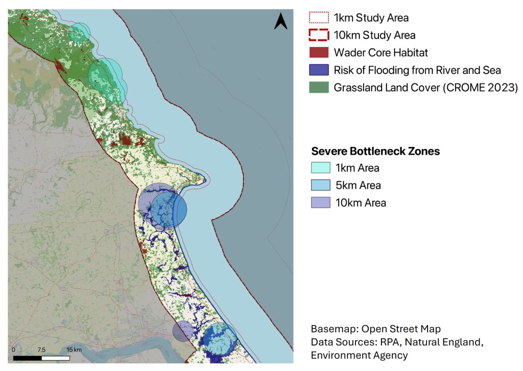
Wader habitat showed the strongest and most widespread severe bottlenecks of any scenario tested, concentrated around the North York Moors National Park and further south along the coast. Soft sediment habitat carried a single severe bottleneck between Bridlington and Filey Bay, exactly where predicted coastal erosion is greatest. Seabird cliff bottlenecks, though comparatively weak, clustered just north of Bempton and around Scarborough and Whitby, marking areas outside current designation that still support nesting colonies. River and coastal stream bottlenecks converged on the Gypsey Race, a heavily modified chalk stream already flagged as a priority waterbody for restoration.
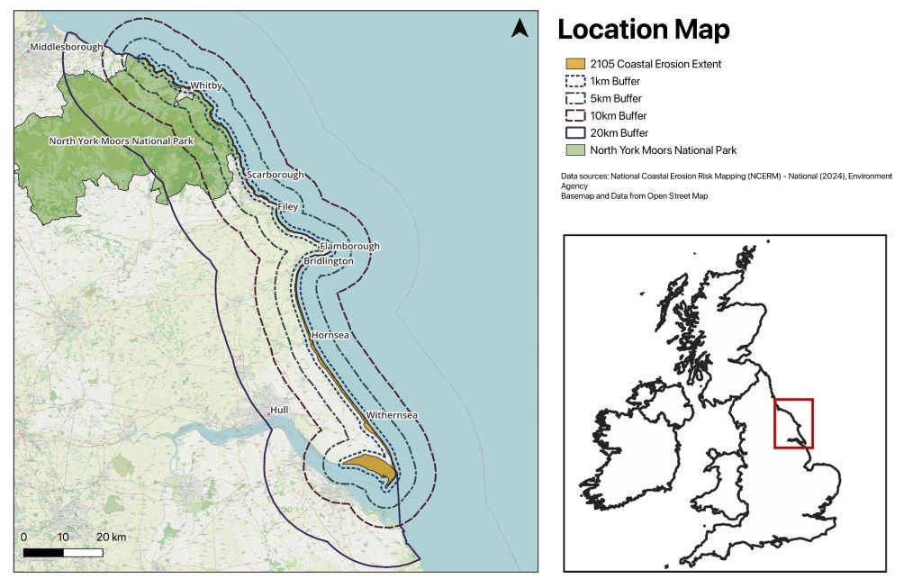
The Yorkshire coast study area, showing the 1, 5, 10 and 20 km buffers used to test connectivity around the predicted 2105 coastal erosion extent.
Bringing partners together around the evidence
This project was shaped from the outset by the organisations already working on this stretch of coast. North York Moors National Park and the Yorkshire Marine Nature Partnership contributed local knowledge and survey data, including wader survey records used to ground-truth the model. The work was funded through Defra’s Protected Landscapes Partnership, a mechanism for joint working between National Parks, National Landscapes and national delivery bodies.
The bottleneck maps give these partners a common reference point: the same evidence can inform multiple projects. For example, National Trails UK can see where the King Charles III England Coast Path and the Cleveland Way National Trail sit alongside the most constrained habitat; the North York Moors National Park can consider land management within their borders, and the Yorkshire Marine Nature Partnership can see synergies with the delivery of the Marine LNRS. Recommendations from the analysis explicitly call for landscape-scale partnership working with landowners, and for the bottleneck locations to inform joint public engagement and recreational management in the busiest coastal locations, so that access and nature recovery are planned together rather than in competition.
Severe wader habitat bottleneck zones shown against grassland cover and areas at risk of flooding from rivers and sea, where reconnecting the floodplain could expand wetland refuge for curlew, lapwing and redshank.
Supporting Coastal Wildbelt’s delivery
Because the Coast Path and Cleveland Way run through or alongside several of the identified bottleneck zones, the analysis gives Coastal Wildbelt a direct route to impact: enhancing the habitat adjoining the trail network, managing recreational pressure on fragile dune and cliff habitat through signage and routing, and using the coastal margin itself as retreat space for wader wetlands and soft sediment habitat as the coastline changes. Each of these actions sits within Coastal Wildbelt’s core mission to make the coastal margin work harder for people, wildlife and climate resilience, now backed by a spatial evidence base showing exactly where that effort will count most for the species the region has identified as priorities.
Client: National Trails UK, for the Coastal Wildbelt programme
Delivered by: Nature Data Solutions
For more information please contact:
Hannah at hannah@nationaltrails.uk
Daneen at daneencowling@naturedatasolutions.com