
Condatis used to incorporate connectivity into conservation planning in Sabah, Malaysia
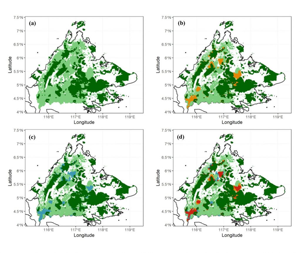
Condatis was used in a planning exercise to identify areas that should be prioritised for increased protection in Sabah state, Northeastern Borneo. State governments pledged to designate new protected areas to increase the overall coverage of protected areas to 30% of their land areas, which will protect an additional 9.4 million hectares. To analyse connectivity, established protected areas were used as the sources, and the targets were determined using climate models to show which protected areas might be climatically similar to the sources in the future.
A separate Condatis analysis was conducted for each of the existing lowland protected areas in turn. The most important additional forest areas to conserve were identified by progressively ‘dropping’ unprotected forest from the landscape and measuring the decline in the speed between the source and target protected areas. The output maps were combined to highlight potentially efficient corridors of unprotected forest that could provide climate change resilience for Sabah’s protected areas. Follow this link to read the original research article.
Condatis identifies under-protection of habitat patches critical for south-north connectivity in England
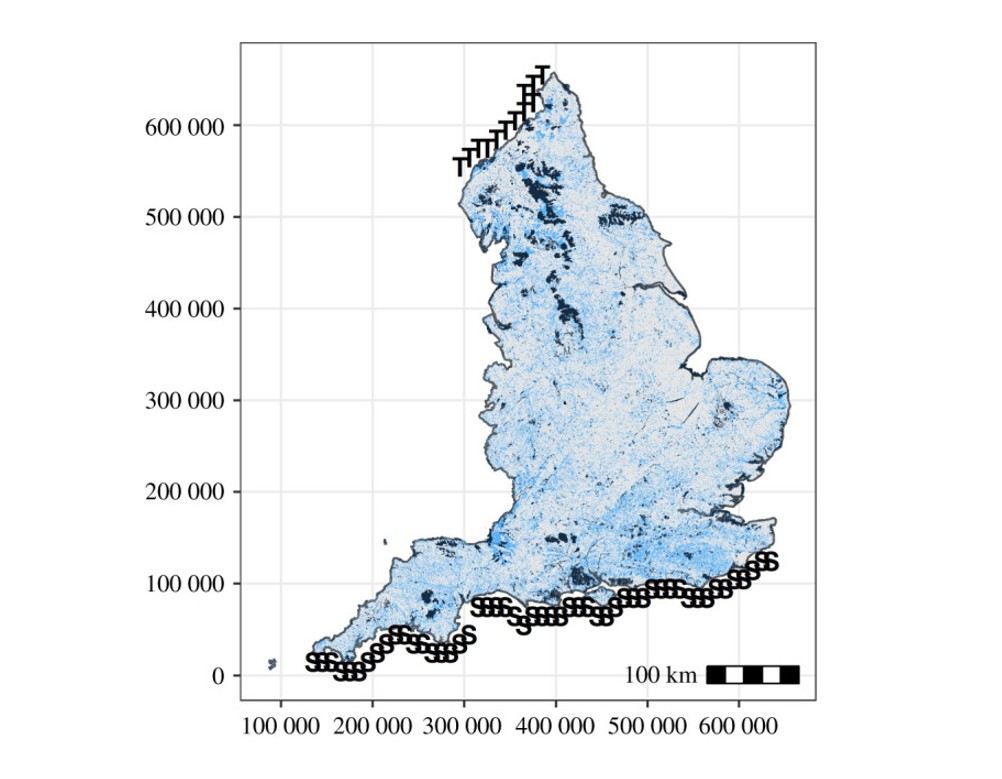
A peer reviewed study used Condatis to identify patches of habitat providing south-north connectivity for species in England that are currently under protected. The project looked at the distribution of 16 priority conservation habitats across England and used Condatis’s flow metric to measure how much each habitat patch contributed to south-to-north connectivity. South-to north connectivity was studied because of the likely effects of climate change. Three example mean dispersal distances were used, to represent poor, medium and good dispersers.
High flow patches of priority habitat were often found outside the existing suite of designated protected areas. Such high flow areas, if destroyed or degraded, would likely severely reduce connectivity across the country. Historically, decisions regarding areas to be designated for conservation protection often favoured larger habitat areas and neglected the importance of connected habitat networks. These past decisions now leave species vulnerable to the effects of climate change due to a lack of suitable habitat to allow species to move through the landscape. This study found that substantial gains in connectivity protection can be achieved with relatively small increases in protected area coverage.
The importance of protecting high flow areas – a bit about how it works
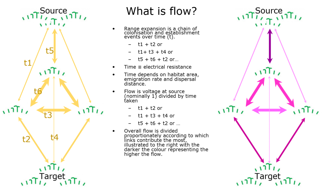
In response to climate change, many species need to move away from their existing habitat to cooler habitats, through moving north or to higher altitudes. To reach a suitable long-term refuge, species must move through the landscape over multiple generations. This can be difficult because suitable habitat to move through continues to be lost, degraded or is increasingly fragmented, but Condatis quantifies how quickly this shift can occur.
Condatis can help identify the parts of the landscape that are contributing the most to the long-distance shifts of species from source to target, by calculating a metric referred to as ‘flow’, for each habitat cell. If a habitat cell in Condatis is identified as having high flow that means it is in one of the likeliest routes for range expansion between the source and target. Similarly, it means that the entire landscape would be less well connected if those cells were removed. Therefore, identifying high flow areas aids conservation planning by pinpointing key areas to maintain and protect to preserve habitat connectivity.